Best Marine GPS
Standout Picks
Criteria Used for Evaluation
Ease of Use
It might be beneficial for a GPS device to be potent in GPS technology, just a thought. When talking about a marine version, though, it is a little different to analyze. Besides the GPS, with some models, there is also the sonar you have to look out for. But, let’s start out with the GPS. Generally, it is always a plus if a GPS is a high-sensitivity version or WAAS-enabled. Both allow the system to locate satellite signals quicker and more efficiently. Also, some will use maps and some will strictly use waypoints.
But, most boating fanatics will be interested in the sonar capabilities of these devices. Not having sonar does not mean a GPS can’t be used in the water, but it offers tons of advantages. In specific, for fishermen, it can be used to detect the fish that are lurking under the surface. Thus, it is no coincidence that you will see some named “fishfinders” as that is their primary purpose. As you probably noticed throughout this list, most top-end models implement CHIRP sonar for excellent clarity of the water.
Portability
Not each marine GPS on this list has sonar capabilities, but this section is aimed at those that do. For the ones that do not, it is still important to know how far they can sink before risking permanent damage. Most will not have huge depth, maybe five feet, but take note of it. However, for marine GPS with sonar built-in, it is vital to not be ignorant and be knowledgeable of how far they will reach.
Choosing what depth suits your needs is as simple as analyzing which bodies of water you plan to visit. If you are going to boat or fish in any of the major oceans or the Great Lakes, you may want to aim for long depths of over 1000 feet. But, if you are a simple fisherman who plans to fish in their local lake, you may not need to worry as the lake may not even eclipse 500 feet. After you answer that question, you then need to make note of the different depths that sonar will travel in conjunction with the frequency and type of water. In other words, some may travel farther in freshwater than saltwater (due to the properties of saltwater). The same goes for the frequency as depending on what is being used, the farther and shorter it may reach.
Effectiveness
This criterion has nothing to do with the performance of a marine GPS, but man is it important. With any technology that has software inside, navigation of the interface will be prominent. When it comes to marine GPS, it boils down to two huge factors: screen size and navigation choice. Firstly, the screen size as well as the resolution. Generally, handheld versions will have smaller screens than mounted versions. To accommodate for convenience, handheld GPS need to be kept as small as possible. So, if you want a massive screen size shoot for a mounted version. From there, weigh how important the size is in your mind as some can range from four to nine inches.
Then, arguably more important, there is the navigation choice. A marine GPS is either going to be controlled via buttons and keypads or a touchscreen. Smartphone and tablet users will probably prefer a touchscreen interface for familiarity. With an extra-large screen size, button navigation can quickly become a hindrance. However, with handheld versions, the screens are small enough where a touchscreen interface could prove to be problematic.
Features
With technology, it is always nice when it is kept as convenient as possible. There is nothing more annoying than devices that are extra complicated and impossible to use. When speaking about marine GPS, it is all about the extra features that add convenience. This really can sway from one device to another, but here are some examples of good ones to prioritize.
For a fisherman, it is nice when the marine GPS alerts you of the speed of your boat (especially if you do not have a speedometer already) when catching specific types of fish. Some other minor features could be the ability to customize the home screen of the interface, sending a distress call when in an emergency, floating on the water when accidentally dropped or lost, and wirelessly connecting to your smartphone.
Top 10 Picks
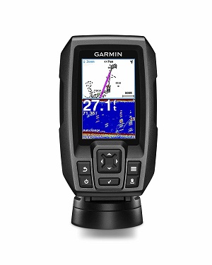
1. Garmin striker 4 built-in
Get used to seeing Garmin on this list as they are one of the top GPS manufacturers in the world today. Their Striker 4 GPS is a perfect handheld device for marine goers. As a handheld marine GPS, it is hard to find much better than the Garmin Striker 4. If the non-mapping GPS technology does not bother you, then this is a no-brainer. Unfortunately, depending on your preference, this device does not include maps but instead waypoints of your area. Because this is a non-mapping GPS, you will not need to concern yourself with this.
Read moreEase of Use
The depth solely depends on the type of water you are boating/fishing on. In saltwater, it can reach depths of 750 feet. However, in freshwater, this more than doubles to 1600 feet. The screen is large enough, 3.5 inches, to get a good interpretation of what you are looking at. Navigation wise, this implements a keypad operation instead of a touchscreen.
Portability
The Garmin striker 4 built-in is very easy to bring with you anywhere as it only weighs 8 ounces and has the ability to work even out in the middle of the lake or ocean.
Effectiveness
Equipped with a high-sensitivity GPS receiver, you can easily view your position in relation to the waypoints that you have marked. It is also simple to locate landmarks such as docks and brush piles. Plus, with a Garmin CHIRP transducer, this will also detail (in high clarity) fish lurking under the water.
Features
If you are riding on a speedboat, this GPS will actually display the speed of your boat on the interface. This comes in handy in instances where you are trying to catch a particular type of fish. In addition, you can also upgrade to higher-performance transducers (GT8 and GT15).
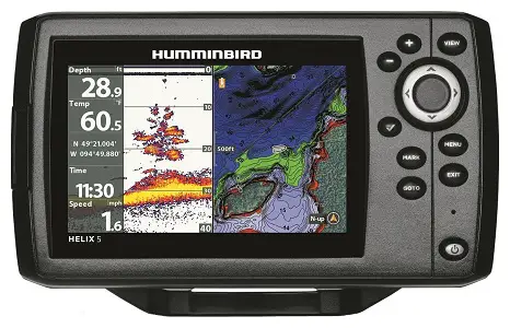
2. Humminbird helix 5 chirp GPS fish finder
The Helix 5 GPS Fishfinder from Humminbird may not sport the most advanced interface on the market, but it is hard to argue with its capabilities as a marine GPS.
Read moreEase of Use
The Dual Beam PLUS sonar system has 4000 watts of power output and the internal GPS will plot maps and charts with a built-in Anima cartography. When needing a second look at an area, using the Sonar Recording feature you can rewind to a particular sonar feed.
Portability
You can expect this sonar system to capture data all the way down to 1500 feet. The resolution, 800 x 480, and size, 5 inches, are not terrible by any stretch of the imagination. Plus, with LED backlighting you can easily view the contents on the screen. But, in this modern world of technology, it may be too basic for some.
Effectiveness
As a GPS and sonar device, the Humminbird Helix 5 knocks it out of the park. The basic interface, which is one of the only issues here, is more of a preference than a hindrance. There is an included microSD card slot so you can upload maps from an SD card. In addition, you can also save waypoints on your SD card.
Features
When you are looking for specific types of fish, you can seamlessly switch between Clear Mode and Max Mode. The former will remove the clutter on the screen and display the strongest of targets. This comes in handy when fishing for monster pike and bass.
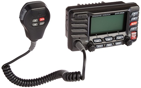
3. Standard horizon explorer VHF
This GPS is a little special as it works as both a marine GPS and communicator. In instances where you may need both, Standard Horizon provides you with an amazing model.
Read moreEase of Use
All the data is implemented directly into the radio/GPS. It also uses waypoints so you need not concern yourself with external maps. This will not be for everyone and is very special in the sense that it is a radio on top of a GPS that can be used for water navigation.
Portability
While it does not have a sonar system, it can be underwater in depths of under five feet for 30 minutes. Anything after that or deeper than that and you risk permanent damage. On the large 3-inch LCD display, you will see an oversized dot matrix display of your coordinates and waypoints. For operation, it is run by various buttons and keypads.
Effectiveness
The Standard Explorer GPS VHF Marine Radio has an internal 12 channel GPS built directly into the front panel. It is capable of entering up to 100 waypoints, which can then be selected and navigated to.
Features
In just a few simple steps, you can send out a DSC distress call in times where an emergency occurs. Plus, when mounting this GPS, the rear case design will grant you flexibility and you can mount it in extremely tight areas to save space.
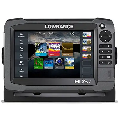
4. Lowrance gen3 fishfinder
While the Lowrance Gen3 Fishfinder is not the most popular GPS device in the world, for marine capabilities, it just so happens to be the best. When the biggest problem is manual, you know that you have an excellent product on your hands. There is not much not to love about this fish finder and it is a necessity for any fishing enthusiasts. Once you figure out how to use it, the rest is history.
Read moreEase of Use
When searching in 2D, this sonar system can travel all the way down to 750 feet. In the StructureScan mode, though, it can only monitor down to 300 feet. This Lowrance gen3 fishfinder is very easy to use especially when you are out on the water.
Portability
For your convenience, the choice is yours between either a touch screen or keypad, operation. Meanwhile, the screen itself dynamically shows high-definition sonar returns with a subtle color scheme.
Effectiveness
This device comes with both a built-in CHIRP Scan Sonar system and an internal GPS antenna. What this provides is an unparalleled view of fish that are lurking under the surface as cutting-edge technology has been implemented.
Features
Using supported smartphones and tablets, you can wirelessly connect with the Lowrance GoFree app. In addition, you can easily switch from outboard pilot steering to the electric-steer trolling motor. Equipped with this GPS device are dual microSD card slots that allow you to add external maps. Plus, with the use of the GoFree app, you can upload maps and obtain new software features.
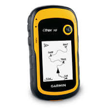
5. Garmin eTrex10 GPS
The Garmin eTrex10 GPS fits the bill for what everyone should look for in a marine GPS. It has excellent GPS and sonar capabilities and convenient features for added use. This Garmin eTrex10 GPS has a display size of 1.4" x 1.7" (3.6 x 4.3 cm); 2.2" diag (5.6 cm) and great resolution measuring in at 128 x 160 pixels. It has over 200 routes for you and displays transflective as well as monochrome. For your next fishing trip, you will want to bring this marine GPS with you to help organize maps and help you decide on which routes to go with. This GPS even helps you plan spots to save for your next fishing trip. It also allows you to save all of this data in order for you to keep a plan throughout your fishing adventure. So even in locations where you have no wifi, this GPS helps tremendously. Its map has a 2D, 3D, as well as a 4D option for you to use in case of emergencies. Overall this is one of the best quality and most popular marine GPS on our list and you can now see why.
Read moreEase of Use
Pre-loaded in this GPS are US lakes, rivers and coastal maps. In addition, there is a microSD card slot in which you can insert an SD card to save screenshots. The double sonar system is what truly stands out here, but the screen is quite smaller than other mounting models. This GPS is very easy to use for even your children once you get the hang of the features and buttons. It includes terrains, locations, maps, and descriptions for tracks as you adventure the waters. This is one of the most simple GPS on our list to use and it even has a lock button which is actually 20 percent quicker than other GPS.
Portability
This comes equipped with a dual-channel sonar. The first is a CHIRP DownVision sonar that is used for photo-like images and the other is a conventional solar channel designed primarily to detect fish. Both of these sonar systems are combined with GPS navigation. This GPS is portable when it comes to using it while fishing as it does not require to be connected to wifi at all times. You can even save routes, locations, tracks or waypoints on the map for you to use while out in the middle of the water. It also weighs just 5 ounces which helps with how easy it is to transport wherever you are going.
Effectiveness
Each sonar system has different depths it can reach with the DownVision able to reach 600 feet and the conventional sonar 900 feet. The screen measures 1.4" x 1.7" (3.6 x 4.3 cm); 2.2" diag (5.6 cm) and is a high-definition LED backlight display that is optimized with sharp colors. With the power of the DownVision sonar system, you can also view photo-like sonar images. You also get a resolution of 128 x 160 pixels which truly helps you be able to see clearly even underwater. You can even share your locations and maps with friends with the Garmin Adventure app.
Features
When you download the Garmin eTrex10 GPS mobile application, you can stream your sonar data directly to your smartphone. Then, you can share your findings anywhere you would like. That helps while you are on family fishing trips with a larger number of people to all be able to know where each of you is. This Garmin eTrex10 GPS displays its map information on a 2D, 3D as well as a 4D screen to help you see its elevation profile. That way in a case of emergency you are able to see where you are located or if you even want to visit that fishing area again you can save the location.
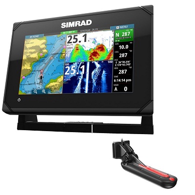
6. Simrad go7 XSE fish finder
One thing is for sure, Simrad got it right with the touchscreen controls for their GO7 XSE Fishfinder. But, it also does a fantastic job in other key areas, as well.
Read moreEase of Use
This is a chart plotter with the fullest of features and several cartography options such as NV Digital Charts and Insight. With the simplicity of touch, you can then set waypoints and record your destinations.
Portability
It depends on the frequency that you are using, but the highest depth you can reach with this device is 1000 feet. Besides its large seven-inch display, you can navigate the interface via the touchscreen. Tablet and smartphone users will find this convenient, and simple home screen and menu layouts make it simple to operate.
Effectiveness
It includes all sorts of maps and charts including over 3000 enhanced US lakes, a USA worldwide Basemap, Hotmaps and Hotspot maps, and optional chart upgrades. When in stable use, this is as good as it gets. There are only a few gripes that hinder the overall quality, but they do not prevent it from being the highest recommendation.
Features
On your screen, you can do more than just simple navigation. Conveniently, you can customize your home screen with the shortcuts that you want. In addition, you can adjust the screen views and the layout of the panel.
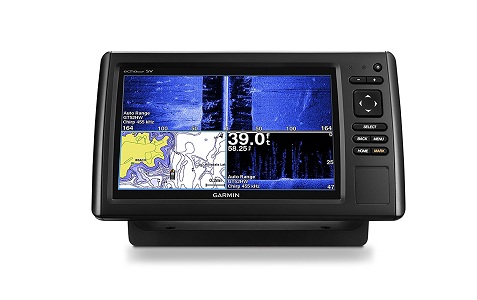
7. Garmin echomap chirp 94SV
It did not take long for Garmin to return, but this time it is their echoMAP 94sv GPS that makes its way on the list. With the way, the interface is built, it would be nice for a touchscreen but that does not take away from its brilliance.
Read moreEase of Use
There are built-in maps and charts and there is availability for U.S. LakeVu maps, Canada LakeVu maps, and U.S. BlueChart g2 charts. Outside of the interface, for use as a sonar GPS, it is hard to argue with the results. Its elite sonar system and GPS make it worth the price alone.
Portability
When you are down imaging, you can do so down to 300 feet. Meanwhile, just using a frequency of 83 kHz and 50 kHz will allow you to view 1000 and 3000 feet below, respectively. The display is available in various sizes, four and five-inch square and seven and nine-inch widescreen. It is easy to see with an auto-dimming and sunlight-readable display. However, the keypad operation probably should be ditched for a touchscreen one.
Effectiveness
With the CHIRP sonar, this device is able to create crisp fish arches and a continuous sweep of the frequencies in the water. Plus, the internal five Hz GPS will update your position five times per second ensuring you are up-to-date at all times.
Features
Outside of the GPS and sonar uses, you can also use the free software Quickdraw Contours. This will create top-of-the-line and personalized fishing maps directly on the interface.
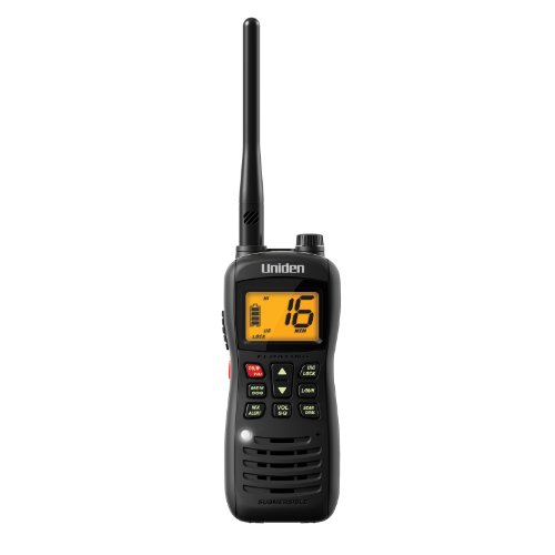
8. Uniden handheld submersible radio
This is another radio/GPS device and while not quite as good as the previous one, it still does its job efficiently. A few drawbacks hinder its overall quality, but as a GPS and a radio, it will suffice for your needs.
Read moreEase of Use
With its GPS technology, marine goers will be able to spot their favorite fishing and diving spots time and time again. Plus, in the case of an emergency, with the DSC system, rescuers will be able to pinpoint your location in the blink of an eye.
Portability
As it works like a radio, there are no maps installed in the software. Instead, everything you need is immediately at your fingertips. If it were not for two huge drawbacks, which will be addressed shortly, this could have easily been higher. However, for what it is, Uniden designed a terrific marine radio and GPS.
Effectiveness
Again, as it is a radio, it has no sonar capabilities but can be submerged in under five feet of water for 30 minutes. The interface is not going to blow you away, but its slim design allows this handheld device to easily fit in your pocket. However, the keypad is easy to operate and the LCD screen provides easy viewing.
Features
In case you accidentally lose this device in the water, it is designed to float to the surface so you can spot it. It also features an NOAA weather alert which will allow you to know of any hazardous conditions heading your way.
9. Garmin GPSmap 276C receiver
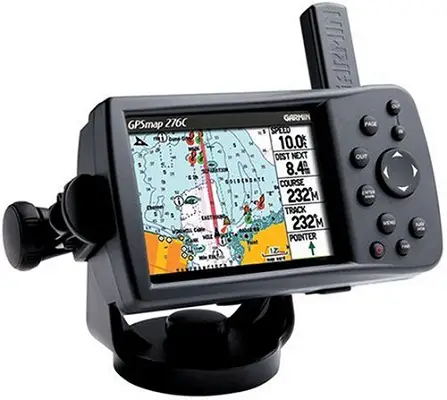
The GPSMAP 276C GPS Receiver from Garmin is certainly not the most advanced GSP on the market, but its GPS capabilities more than make up for that.
Read moreEase of Use
To deliver superior data reception, the GPS receiver is WAAS-enabled and has an adjustable quad helix antenna. Plus, there are 3000 user waypoints of data that are included.
Portability
t is compatible with BlueChart g2 maps and also accepts various optional MapSource data cards. Plus, when needing to make a map transfer, you can easily connect the 276C to a device with a USB port. There is nothing technically “wrong” with this marine GPS, but it is not necessarily setting the world on fire. For most people, though, this will be an awesome addition to your boat ride.
Effectiveness
It is waterproof to IPX7 standards. What this means is that it will be protected against splashing water and short duration of water immersion. The resolution and screen size is certainly not hi-tech, at only 480 x 320 and 3.8 inches, but the enhanced sunlight readability does make it generally easy to see in daylight.
Features
If you want to use this past the marine life, you can use it in your vehicle and receive turn-by-turn directions to your desired destination. When using on water, there is a built-in feature that will inform you of when your boat has veered off the correct path.
10. Garmin GPSmap 78SC waterproof
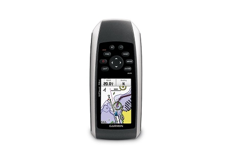
This list might as well cap off with Garmin and their last product to make this list is the GPSMAP 78sc.
Read moreEase of Use
Pre-installed on this GPS are BlueChart g2 U.S. and Bahamas coastal charts of marinas, shorelines, depth contours, harbors, and more. With a microSD card, you can also add additional maps if you so choose. If it did not feel like a device from the 20th century (in terms of the interface), this would be top-end quality.
Portability
Being waterproof to IPX7 standards, it is a perfect handheld device to use on your boat or in the water. Unfortunately, this could be a deal-breaker for some. The interface, while not terrible, is really outdated with a small 2.6-inch screen size and keypad operation.
Effectiveness
It has a high-sensitivity GPS receiver making it lock on to satellites quicker. Also, it has a built-in triple axis compass and barometric altimeter.
Features
If you enjoy sharing your tracks, waypoints, routes, and geocaches with others than the GPSMAP 78sc will accommodate you. With any compatible device users, you can wirelessly share this information. Plus, the device itself will float in the water.
Sources
- , 10 best marine gps , article
- , 7 best marine gps systems of 2019, article


