


Garmin eTrex10 Handheld GPS
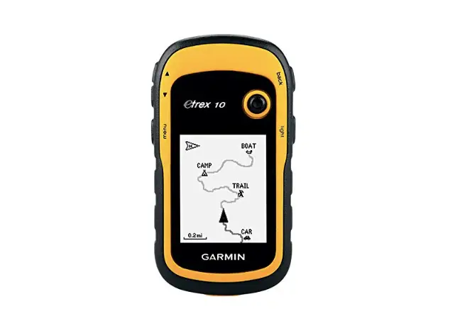
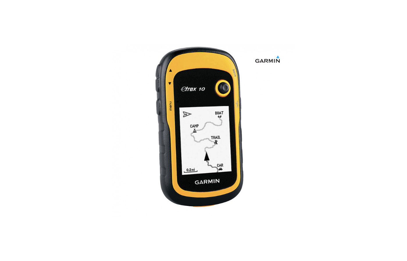


Thinking about getting a Garmin GPS device, but don’t know which one to buy? Consider the basic and straightforward Garmin eTrex10. It is a handheld navigator GPS. This device is rugged, waterproof, and lightweight.
Navigation is by side buttons and a rolling ball joystick feature that is simple to operate with one hand only. Ideal for backpacking, hiking, geocaching, geotagging, and general outdoor exploration use, the eTrex 10 is WAAS enabled with a worldwide base map preloaded. It has BaseCamp software, HotFix support, and the tracking satellites of GLONASS and GPS installed. Among the family of GPS devices from Garmin, the eTrex10 is a choice that is basic, economical, and great for the beginner GPS user.
If interested in buying then you should also compare it with Garmin GPSMAP 64S. Read our review and find out more about this model of Garmin!
Handheld, rugged, and lightweight
Screen can be seen easily in sunlight
Reliable signal and fast positioning
Good to use for geotagging photos
For hiking, geocaching, backpacking, and general use
Waypoints are marked easily with one click
Battery life is great
IPX7 waterproof for 30 minutes to one meter
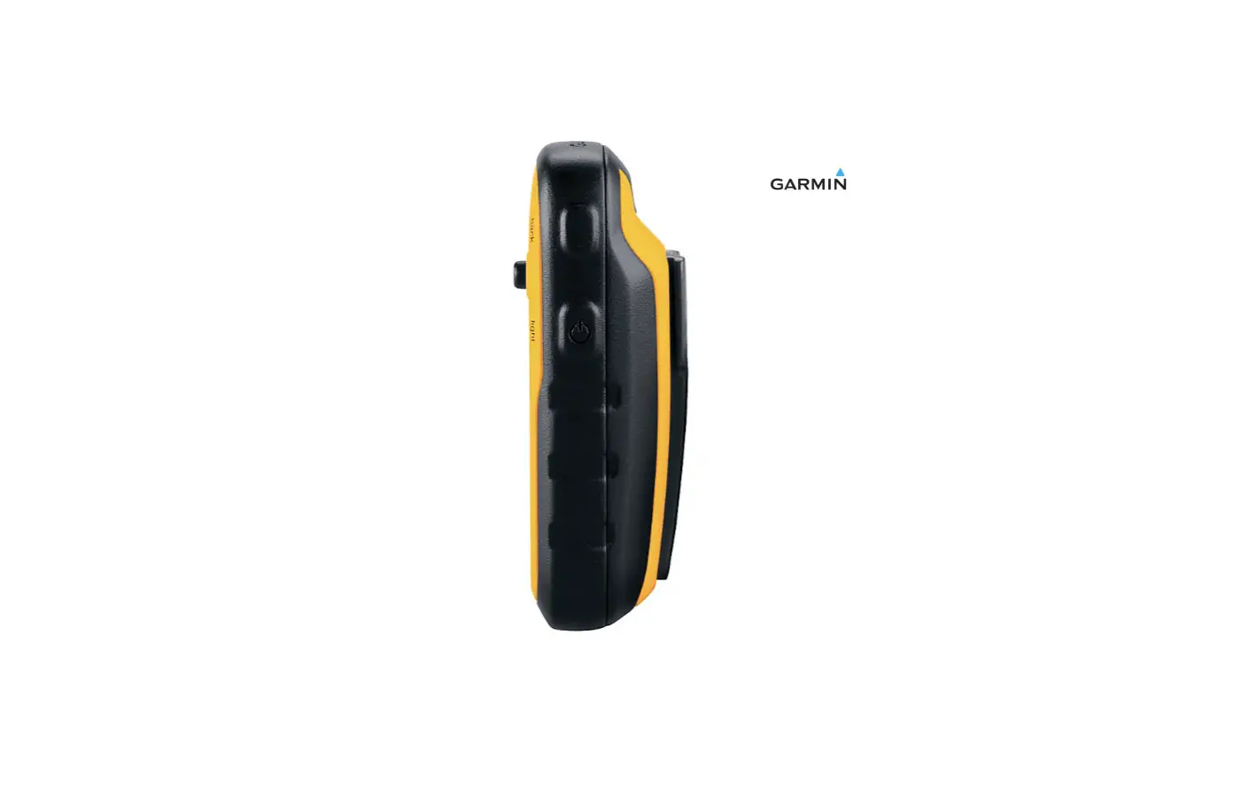
Side buttons for functioning - one hand operation
Lacks the features and maps of other eTrex models
Black and white screen is not as sharp as one in color
No preloaded maps; works slower than other models
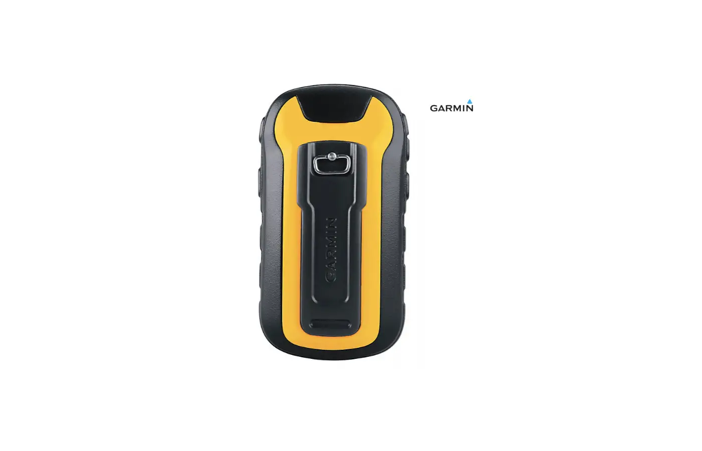
Joystick cannot be turned off or controlled in a pocket or pack
Brand
Some buyers that have both models say that the new one is better than the original, does not cost as much, has more accurate readings, and provides more data for the user. On the other hand, some feel the older eTrex is superior because it does not have the often problematic joystick controller, and the display is better. Personal preference determines which is best based on what the user likes the most.
Since the introduction of the eTrex10, Garmin has created the eTrex20x and the eTrex30x too. We give you more information about these in the Version section of this review to help you decide which one is best for you.
Durability
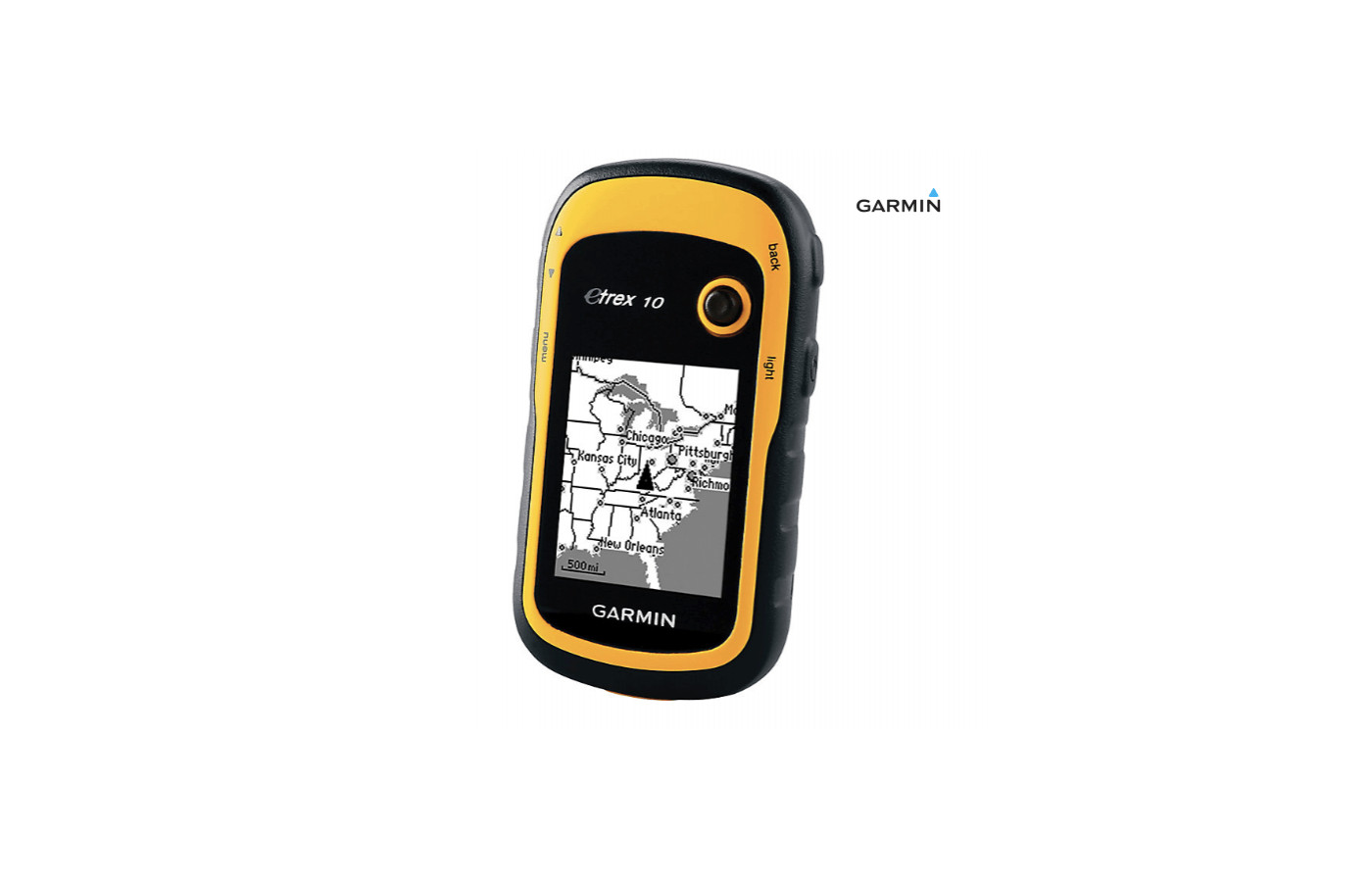
Its altimeter is satellite-based, and the screen can be seen easily in sunlight because it is black and white. The black and white screen is a controversial point with customers because full-color screens are available and often preferred. However, because it lacks color graphics, visibility is improved outdoors.
Flexibility
Both the buttons and joystick can be manipulated easily with bare or gloved hands. The issue that some people have with the joystick controller is when it is put in a pocket or backpack. There is no way to shut off that part of the mechanism, so it accidentally flips through the screens and maps without your knowledge.
The Garmin eTrex10 shows low and high elevations points along with waypoints of a track that will provide the estimated distance and time between two points, plus it is compatible with Windows. Another versatile aspect of this product is its ability to withstand water. It is water-resistant IPX7 and tough, so it is protected from rain and splashes. This item is waterproof for 30 minutes as deep as one meter, so you can drop it in puddles or streams without harming it.
Responsiveness
Also, the Garmin eTrex10 shows topographic data of maps on a computer screen in 2D or 3D images with elevation profiles and contour lines visible. On the black and white screen, you have all the essential information needed to guide you along the way of your journey plus leave breadcrumbs for you to follow your way back in case you become lost out there.
Size
This is not the lightest GPS model out there, nor is it the one with the largest screen. The Garmin eTrex10 is a basic model that is economical for those that do not want to shell out a lot of money for a simple navigational device. It does not have all the bells and whistles that some of the other products have, which honestly, is not desired by plenty of folks that want a GPS mechanism.
Stability
You can even use BaseCamp to make Garmin adventures and share them with other companion explorers, friends, and family members. When combined with the Birdseye Satellite Imagery, you can send any number of satellite views to a device. It will find your position precisely and quickly to keep the location accurate even in difficult terrains such as canyons and thick brush. With this technology, you should never be lost anywhere because the eTrex10 has your back with its mapping skills.
Support
This is the initial receiver to have both GLONASS and GPS tracking of satellites at the same time in one device.The GLONASS satellite, in case you did not know, is a Russian Federation system that works 20% quicker than a GPS. Within this one product, you have both of these technologies at your disposal to keep you on track in the wilderness.
Use
How is that for innovative? It works much better than phone apps for geocaching especially in strange and remote places and can be much cheaper than other methods of tagging and timestamping photos in the field. Anywhere you need a handheld GPS device is the perfect place for the eTrex10.
Version
The display type is slightly different with monochrome, and the other two are 65K color TFT. The eTrex10 has only 50 routes while the other two have 200. It does not have compatible custom maps, ability to put on more maps, an electronic compass, or a barometric altimeter.
The display resolution of the eTrex10 is less with 128 x 160 pixels. The other two are 240 x 320 pixels. The physical size of theTrex10 is thicker and not as wide as the other two versions.
All of them have the same battery life of 25 hours, the same weight, and Bluetooth technology. The eTrex10 has been purchased more online and has more reviews from customers than the other models and is more economical. What does this mean?
The Garmin eTrex10 is cheaper, thicker in size, with less resolution and routes, and a monochrome display instead of color. It lacks the ability to load maps, a compass, and a barometric altimeter.Otherwise, all three eTrex models are fairly the same.
Accuracy
In the controversy of which is better this model or the original eTrex, some users that have both models claim that the eTrex10 is not accurate and works with terrible lag time. Others feel that even this primary mechanism can be confusing to operate for those that are new to GPS models.
At the same time, some think that this is one of the more manageable devices that can be used without the instructions even. As you can see based on customer opinions, how you will feel about the Etrex10, and how it functions will depend significantly on your background knowledge of GPS devices.
Ease of Use
This product works with Garmin accessories for spine mounting. However, the black and white screen is not as sharp as one that is in color, and it could use a lanyard or clip to secure it to clothing or backpack. The Garmin eTrex10 fits in a pocket easily, but that does not work well with the joystick that moves around in a pocket or backpack. It will navigate through your maps and routes on its own without your knowledge as you journey along your path.
Power Source
Bottom Line
It has no preloaded maps, can be slower than others and has a joystick controller that can be a problem sometimes. On the other hand, the Garmin eTrex10 is a product of high quality that is economical, basic, rugged, and designed to guide you in unfamiliar territories. For a simple handheld GPS product without all the flashy features, the eTrex10 is one of your better models currently.